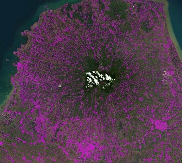
OSM (OpenStreetMap) is a project similar to the Wikipedia version of the map, where people around the world jointly create maps, and volunteers contribute to creating free maps every day. However, Facebook announced that it has begun to commercialize Map With AI , an AI mapping service. Using Mapwith AI, it is said that the creation of a map that will take six and a half years will be completed in just one and a half years.
Until now, online map production was a form of manually adding road types and location data to satellite images. This technology has the problem of being burdensome for workers and not being able to create remote maps that no one can go to. To solve this problem, Facebook has developed MapWith AI, a production service that automatically identifies roads and displays locations and shapes on a map.
It was reported in April that Facebook has developed Map with AI. The announcement this time attracts attention in that Map with AI is making great achievements. MapWith AI uses a deep neural network (DNN) model. It identifies roads, rivers, fields, etc. that seem to be hidden by trees in satellite images, or terrain that seems to be not actually a road in satellite images. Of course, data itself such as road, place name, and building name, which could not be determined by Mapwith AI, must be entered by manpower.
The Facebook research team has used MapWith AI to map roads in remote areas of Thailand about 300,000 miles. Thanks to MapWith AI, the duration of the Thai mapping project, which was scheduled to take from four and a half to six and a half years, has been reduced to one and a half years. Mapping projects using Mapwith AI are being conducted in Afghanistan, Bangladesh, Mexico, Nigeria, and Uganda, and more than 90% of road data has been entered in Indonesia.
Facebook said that map data plays an important role in disasters and policy decisions, and that MapWith AI is one of its goals to create a world map in cooperation with the OSM volunteer community, as it was not possible to create accurate maps in many rural areas around the world. It is revealing. Related information can be found here.

