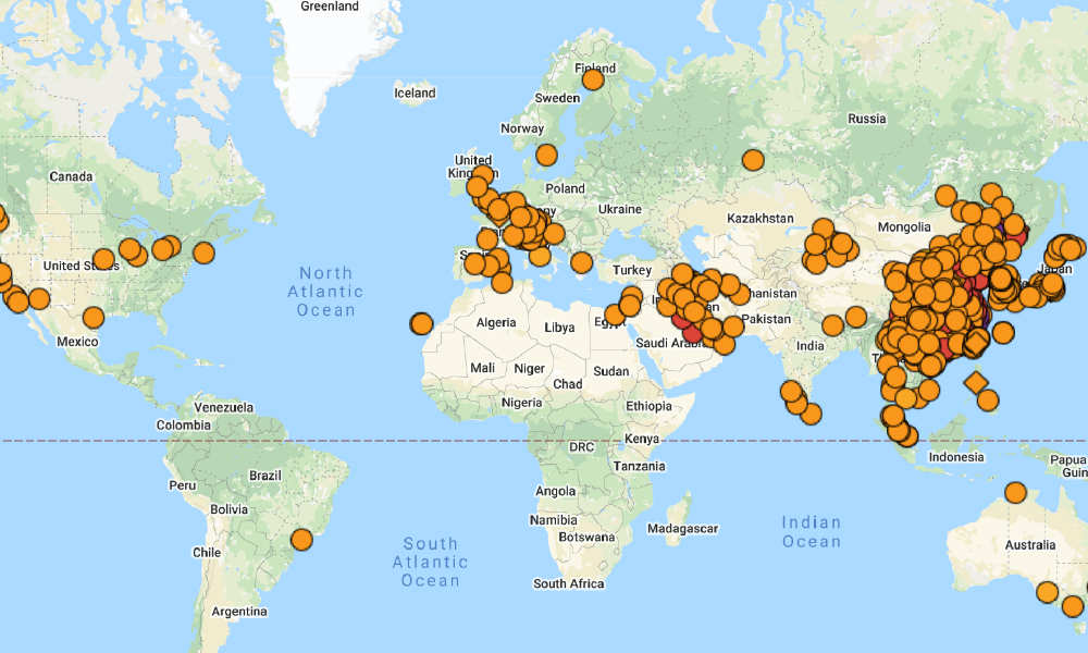
BNO News Coronavirus tracker (BNO Noticias Coronavirus tracker) is a new coronavirus that has spread around the world since December 2019. It is a map made to visually identify the number of infected people at each location.
This service displays information based on announcements from public institutions related to infections, such as the US Centers for Disease Control and Prevention, and the China National Health and Safety Commission, and reports from news agencies on Google Maps. Looking at the map, you can visually confirm that the source of infection has been reported in the United States, the EU, and Iran as well as around China.
[googlemaps https://www.google.com/maps/d/embed?mid=1a04iBi41DznkMaQRnICO40ktROfnMfMx&w=640&h=480]
Within the service, black circles indicate cities with more than 1,000 cases reported, and oranges indicate cities with less than 20 cases. In Hubei, where Wuhan, the cause of the outbreak, is located, a black circle and a black square icon are mixed, and the square icon means that there is a dead person. If you click the icon, you can see the number of infected people in the city and case reports.
Not only that, but also the policies implemented in the city. In the case of Wuhan, the first record was an emergency report on the treatment of unexplained pneumonia reported on December 30, 2019. It was announced by a doctor who worked at Wuhan Hospital to sound an alarm about the novel coronavirus. He died of the virus on February 6th.
Iran is also spreading the infection, and San Francisco, California, where there are many reports of infection in the United States, declared an emergency on the novel coronavirus on February 27. Related information can be found here .

