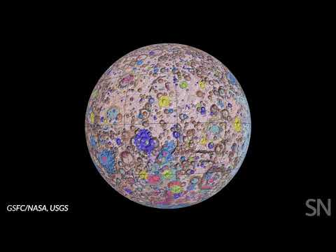

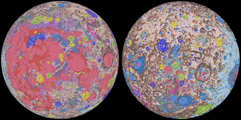
On April 20 (local time), the United States Geological Survey (USGS) released a map that summarized the geological data for the entire moon.
The surface of the moon varies greatly depending on the place, such as the plains and craters, and the geology and strata that form it vary from place to place. Therefore, USGS began creating lunar geological maps in cooperation with NASA from the 1960s. Since then, separate geological maps have been created for each region, but the terms and geological classifications have not been unified due to the influence of different mapping dates. Due to this problem, it was difficult to integrate the map, making it difficult to create a lunar geological map.
However, the research team that conducted this survey corrected six geological maps created during the Apollo Plan using recent geological data observed by the lunar satellite LOLA and the lunar equator elevation data observed by the Japanese lunar satellite Kagaya. All of them were collected to create a geological map of the first month.
The geological map has a scale of 1:5,000,000, and craters and plains are classified by geology and strata, and detailed explanations for each are summarized. The United States has been pushing ahead with a manned lunar exploration program, but the geological map is expected to help this project. Maps can be downloaded for free from USGS. Related information can be found here .