NASA’s Jet Propulsion Research Institute and a research team at the University of Bath in England have devised a new way to use high-resolution satellite imagery. It is used to analyze small changes that may be a precursor to the collapse of structures such as bridges.
For infrastructure such as bridges, local governments are responsible for prevention by conducting regular inspections. But maintaining this state requires a huge investment. If this inspection is not done properly, it can cause the building or bridge to collapse. Recently, a sensor that autonomously reports movement traces, which is an indicator of a building condition, can be introduced through a cellular or wireless data network, or remote monitoring of places such as bridges is possible through this. However, these sensors only check for problems that occur in the place where the sensor was introduced, not all of them. Placing all the sensors on the leg can be a financial burden.
For this reason, I am trying to use satellite photos. Using multiple pieces of high-resolution radar data from a bridge in space, the joint research team succeeded in creating detailed 3D models of buildings with precision from real to millimeters. The research team later analyzed this model with an algorithm developed to detect unwanted movement or deformation throughout the entire building, allowing the entire building to be checked rather than an arbitrary part monitored by a very small sensor.
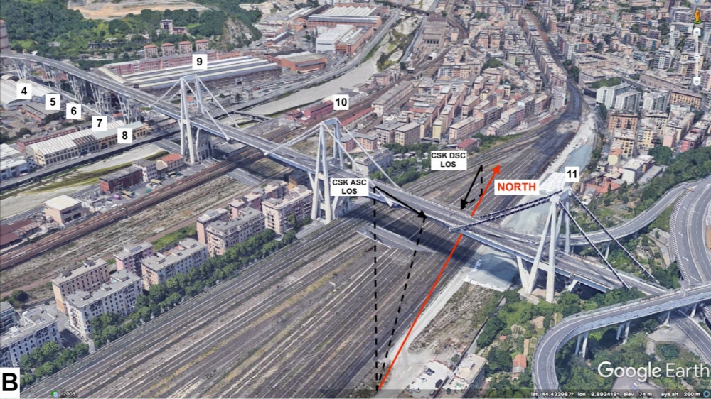
In August 2018, 43 people died when a bridge in Genoa, Italy, was lowered. The research team said that as a result of applying satellite images of this bridge for 15 years to modeling technology and algorithms, it has discovered signs of warpage-like deformation months before the collapse.
This study suggests that the technology can be useful in real-world situations as well. While this approach couldn’t help in Italy, it has the potential to prevent the same tragedy from happening somewhere in the world. Relying on software and relatively accessible satellite data, monitoring of structures such as bridges can be solved with only a small organization. Detecting a building’s danger signal months before something becomes noticeable about physical damage can give your posture time to assess or renovate before it gets caught up in tragedy.
The research team suggests that the technology could also be used in construction projects, specifically for monitoring existing or nearby buildings that could be affected by construction or mechanical noise throughout the day. It is expected that it can also be used for guarantees that ground structures are not affected depending on projects underway such as tunnel excavation. Related information can be found here .


Add comment