
When an accident occurs, one of the most important information when reporting to emergency services is location information. With the advent of smartphones, emergency notifications can be made anytime, anywhere if only radio waves are available. However, it is difficult to accurately determine the location of the smartphone, and an error of up to 10 km or more may occur. For this reason, Google is providing ELS (Emergency Location Service), an emergency location information service that dramatically improves the accuracy of Android smartphone location information in emergency situations.
Maria Garcia Puyol, an engineer in charge of Google Maps geolocation services, learns that the state-of-the-art geolocation technology used in dispatch and delivery services is not being used in emergency services. That’s why we started a project to improve the accuracy of emergency location information.
For over 10 years, Puyol has appealed for the need to improve the accuracy of emergency location information, and has worked with the European Emergency Contact Association EENA to develop a service that can specify location information with high precision while working with various organizations that seek rescue and relief across Europe. .
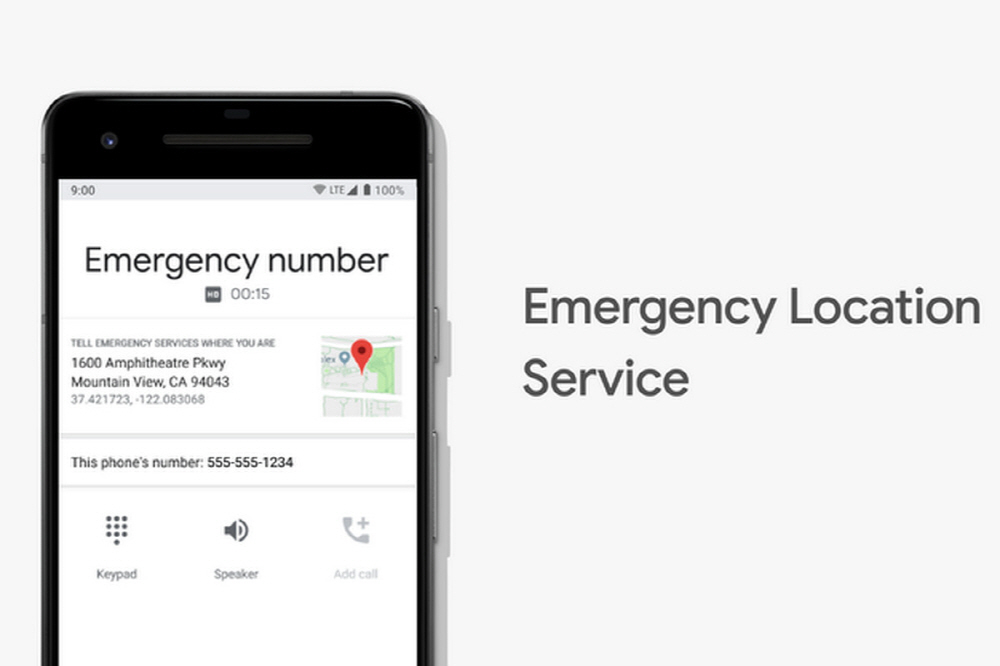
ELS was developed in this way. ELS is one of the features included in some of the Android 4.0 or higher operating systems. You don’t need to install any other apps and only activate when you report to emergency services.
Before using the ELS, there was no choice but to guess from the nearest base station information, and an error of more than 10 km could occur depending on the location. However, if ELS is used, it is possible to check the position with high precision, with errors ranging from several to tens of meters.
Location information by ELS is calculated locally on a smartphone through FLP (Fused Location Provider), which can search for a location in an optimal way by combining GPS, Wi-Fi, and various sensors, and sends data SMS in AML format or in Google’s own format. Is transmitted through HTTPS protocol. By using this location information as the recipient of the emergency notification, the party trying to rescue the reported distress side can be identified.
The first achievement of ELS was in January 2017. A man residing in Lithuania has a seizure and collapses, and his son next to him is embarrassed and presses a smartphone emergency service. The 7-year-old son said that the limit was limited to a 14km radius even with the nearest base station information because he could not tell his home address.
However, since Lithuania was in the ELS region, it succeeded in specifying the male location based on the location information of the male smartphone. This man was taken to a nearby hospital. In Europe, it is said that 70-80% of emergency notifications come from smartphones. It is expected that a quick life-saving through ELS is expected.
Puyol said the goal was to no longer make people who died because they didn’t know where they were in the time limit between life and death. He emphasized that if the victim could help whatever situation he faced, he would be able to help. Related information can be found here .


Add comment