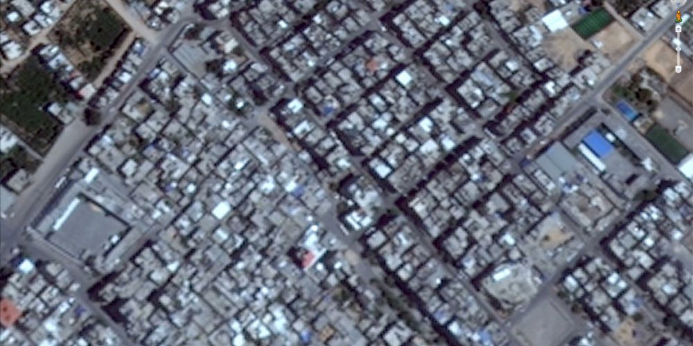
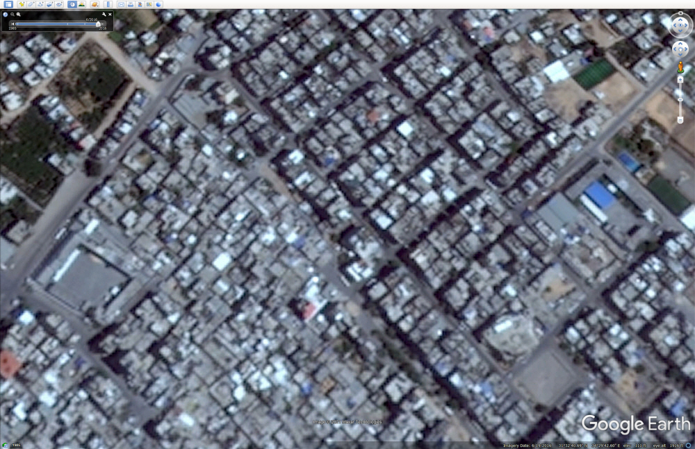
The Gaza Strip, Palestine, is a region frequently under siege by Israeli forces. Human rights groups and researchers are confirming the situation of persecution in regions around the world using satellite images. However, on Google Maps, the satellite image quality of Gaza is very low, and there is a problem that you can hardly see the streets.
The Gaza Strip is often targeted by Israeli forces, so researchers observing the situation in the region must determine which locations were attacked. However, all satellite photos displayed on Google Maps are not clearly visible in the streets at low resolution. In fact, you can see the city itself, but the image is so blurry that it is difficult to see the building and the boundary of the building. It does not become clear even if it is enlarged. Similarly, if you check downtown Pyongyang, North Korea, you can clearly see the number of cars parked and the color.
Google is receiving satellite images from satellite or earth observation service companies (Maxar, Planet Labs) and combining them to create an aerial photograph of Google Maps. Google says it will regularly update these images so that Google Maps can reflect changes in the world. Google also explained that it frequently updates places where population density is high and roads and buildings are actively built.
But now, Google displays sharp images in less populated places than Gaza, one of the most densely populated places in the world. One expert pointed out that the recent Google Earth image of the Gaza Strip was from 2016, which is like garbage, and pointed out that it has secured more than 20 high-resolution images acquired since 2016 by expanding random rural areas in Syria.
In the United States, in 1997, the Kyl-Bingaman Amendment was enacted, prohibiting the use of clear satellite images on important military facilities of the United States and its allies. Under the influence of this law, US companies are prohibited from selling clear satellite images of Israel and Palestine. To the last, the law has been established for some facilities. It does not impose restrictions on satellite imagery for a wide range of locations, such as the entire Gaza Strip. In addition, the 2020 law amendment has eased the 2m ground sample distance limit to 0.4m.
In other words, as of May 2021, Google has no reasonable reason to use vague satellite images on Google Maps of Gaza. However, when the reporter contacted Google, Google said it was considering updating the satellite image when a higher resolution image became available, but said it has no plans at this time. Meanwhile, Apple, which provides satellite images through the app, said it is working to update higher resolution images.
Satellite imaging is important for investigating human rights violations. The persecution of the Rohingya people in Myanmar has been confirmed by satellite imagery that the village is burning extensively. Google, which provides a service for viewing satellite photos, is also receiving frequent updates on high-resolution images. Related information can be found here.


Add comment