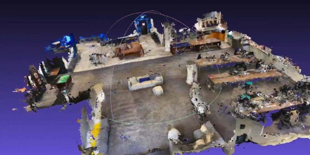
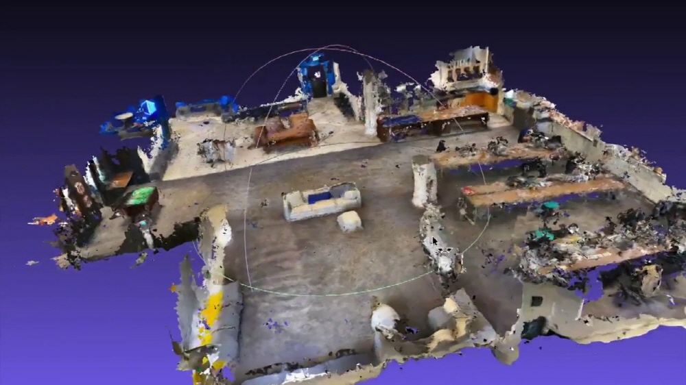
6D.ai , a start-up from Oxford University, is developing a technology to shoot the real world using only a smartphone camera and create a 3D map directly from this video. The company, which is attracting attention for its technology, has released a demo video to create a 3D map by shooting a 460m2 wide space with multiple smartphone cameras and combining information.
The company’s CEO, Matt Miesnieks, points out that as a task in the field of AR, AR experiences are far from real experiences. Because the reality and the AR world are not perfectly connected, unrealistic apps such as the appearance of dinosaurs in the AR space appear, but the expansion of the real space, which is the original strength of AR, is not progressing.
For this reason, it is AR cloud technology that is said to be important. AR Cloud is a way for many people to connect AR experiences and share experiences or object installations in AR with multiple devices over time. This means that it holds the key to full-fledged AR dissemination.
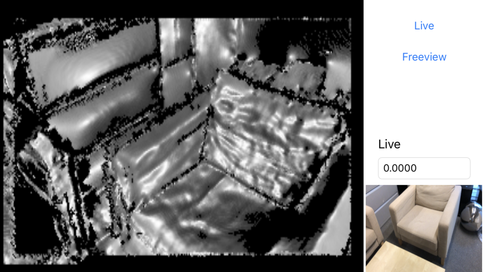
The key to building AR cloud technology is the ability to create real 3D maps. The company has developed a technology to easily create 3D maps using smartphone cameras. In the demo video, each of the four people shoots indoors with their smartphone cameras. The system developed by 6D.ai can generate real-time 3D maps. Objects such as sofas, tables, and desks are transformed into 3D one after another to build a 3D map that fits into the real space.
This model is SLAM (Simultaneous Localization and Mapping) that simultaneously estimates the location of the camera and performs 3D mapping, and a new 3D map is built whenever new data is input. Since 4 people shoot separately, there is overlap, but the 6D.ai system supports a model that can perform 3D mapping by fusion of this data, and improves previous data based on the redundant data.
It took 3 minutes for 4 people to search the 460m2 indoor space. It is usually a smartphone camera, and it doesn’t have a special depth sensor. 3D maps can be built with a general smartphone.
If you look at the 3D map actually created, there are blurry areas such as the glow, but you can also see the location of the sofa, cushion, desk or chair. Of course, the 3D map can be rotated 360 degrees and viewed from various angles. Using this technology, multiple people can scan a city and create a 3D map in a few days. If millions of people from all over the world cooperate to build a 3D map and take pictures around their homes or travel with their phones, 3D maps for the entire planet can be made possible within a year or two. Related information can be found here .


Add comment