
The 2010s will be remembered as a decade when climate change has no doubt. Climate change has been undeniable for decades, but in the 2010s, what climate scientists predicted became reality. It has entered an unstable era, such as the end of 10 years as if there was always ice in the Arctic or the relatively mild weather was natural.
The impact of climate change is felt by everyone on Earth, but images from satellites show more clearly what is happening on Earth. NASA and the European Space Agency’s ESA satellites, which travel 450-800 kilometers above the ground, are enhancing our understanding of the Earth. Of course, it also brings groundbreaking discoveries from the North Pole to the South Pole about climate change.
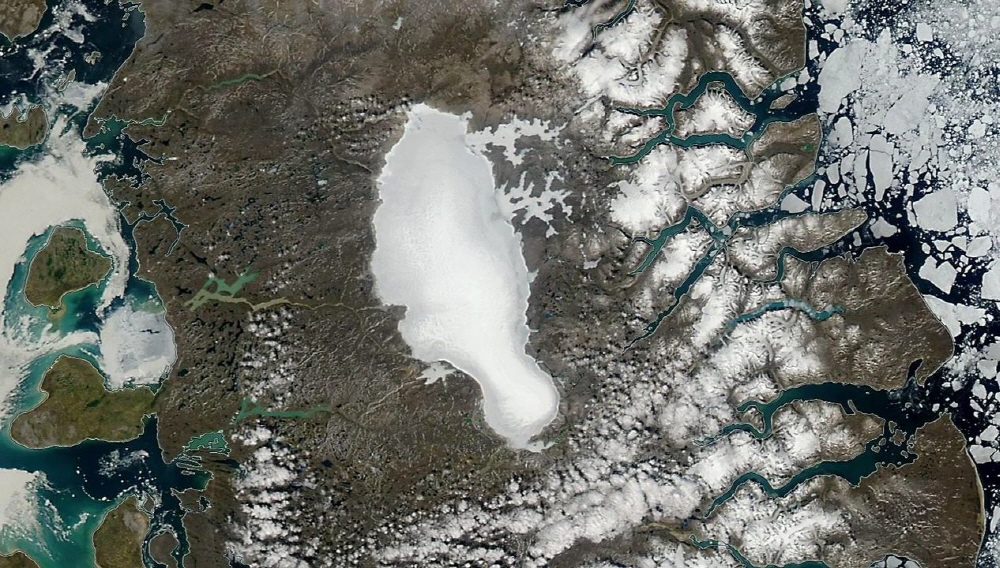
Ice is melting all over the world, so you can choose from hundreds of candidates, but the Barnes Ice Cap, located in Canada’s Arctic Circle, was one of the oldest ice on the planet, covering from north of Canada to Chicago, USA. According to a study published earlier last year, some ice appeared 115,000 years ago.
However, the remaining ice from 100,000 years ago is disappearing due to the rapid warming of the Arctic. In the NASA satellite image, you can see that the glacier shrinks and turns darker. As the ice surface darkens, melting accelerates to absorb more solar energy. It will still take several centuries to melt, but changes in recent decades seem to have determined the fate of glaciers disappearing.
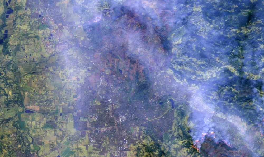
In the western United States, in the 2010s, wildfires caused by warming-induced dryness and rising temperatures became synonymous with California. The top five of the largest ever observed wildfires occurred in the 2010s. Seven of the 10 most damaging wildfires in California were recorded in the 2010s.
In 2017, the Northern California wildfire, the Tabs Fire, was the second most damage observed. In Santa Rosa’s North Bay, the fire burned 5,363 structures on 37,000 acres. The ESA satellite imagery was captured immediately after the evolution and two years later, and the damage from wildfires can be seen. Reconstruction of the most severely damaged areas is still only in its infancy.
This wildfire inflicted the greatest damage at the time, but the campfire that occurred in 2018, the following year, exceeded that damage. Now, how to revive to prevent damage that may occur in the future, and what to do with areas surrounded by forests, remains a challenge.
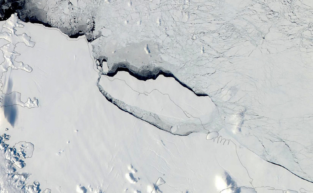
The iceberg separated from Larssen C, located on the Antarctic Peninsula, has attracted high interest among climate scientists. The crack was discovered in Larsen C in 2016. Ice cracks continue to increase across the sea level, causing huge icebergs to separate, affecting the remaining ice layers and subsequent glacial movement.
In July 2017, one year after the discovery of the crack, the iceberg (Dubbed A68) was finally separated and an iceberg covering an area of 5,800 km 2 fell into the sea.
What will happen to the Larsen C ice layer in the future is not yet known. Nearby Larsen A and B collapsed in 1995 and 2002, respectively. Although the ice is melting by warm seawater, this collapse and separation are said to be almost a natural phenomenon. What will happen to the separated iceberg? It is still leisurely north of the Antarctic Peninsula. When it reaches turbulence it will change its shape from ice to liquid.
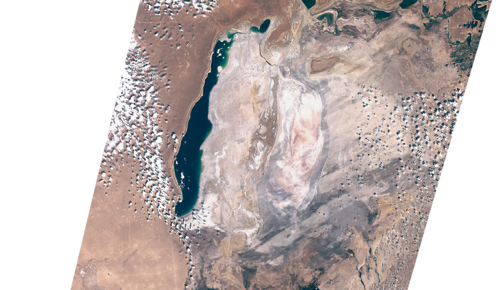
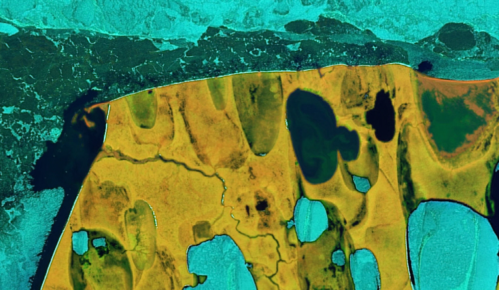
The Aral Sea began to decline across Kazakhstan and Uzbekistan for longer than the 2010s, but the momentum did not stop even in the 2010s. Once the world’s fourth-largest lake, the inland sea began to shrink in the 1960s as the Soviet Union blocked two inflow rivers for agriculture. With the addition of drought caused by warming, desertification has progressed, making the local climate more difficult.
The satellite image shows that the water in the east of the Aral Sea in the 2010s disappears, and only the west is the water. The water level has risen somewhat thanks to the dam, but desertification is progressing in the south.
Drew Point, Alaska, USA is located on the coast 110 km southeast of Utqiagvik, the northernmost city in the United States. Since the sun does not rise in winter, it is dark for 24 hours and is too cold, so you have to worry about polar bears. But the most worrying thing is the rapid progression of coastal erosion.
When storms and sea ice melt overlap, permafrost and tundra the size of a house disappear into the sea. Recently, it is said that the coastline is retreating by up to 1.5m per year due to erosion. Erosion releases greenhouse gases from permafrost.
Facing the difficulty of losing the coastline is a problem not only for villages, but also for the entire Arctic coastal region. The village of Kivarina in northwest Alaska became inhabitable due to erosion and became the first place in the United States to migrate as climate refugees.
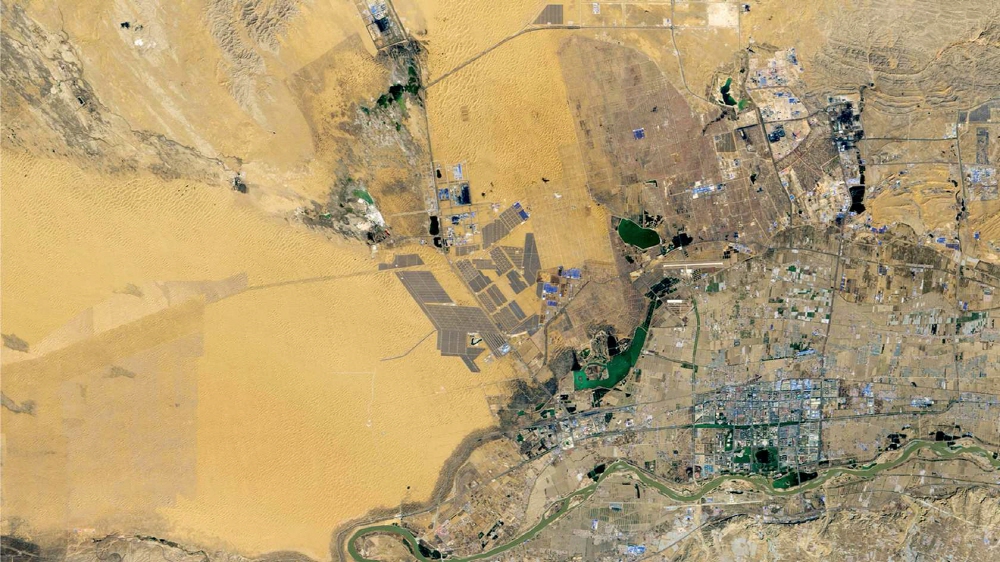
Renewable energy is one of the solutions to the climate crisis. In the 2010s, the transition to renewable energy failed, but at least some progress has been made. Tengger Solar Park is the world’s largest solar power plant located in the Hui Autonomous Region of Ningxia, China, covering an area of 41 km 2 . It has 1.5 gigawatts of power generation capacity and can power 380,000 households in the United States.
The rapid growth of wind and solar power in China and around the world in the 2010s is good news, but even with wind and solar power combined, it is still only 10% of the world’s power generation and is not keeping up with the increase in demand. To avoid the devastating effects of warming, global carbon dioxide emissions must be reduced by 8% annually in the 2020s. Even these giant solar power plants are just a few of the means needed to achieve this goal.


Add comment