
Google and Jaguar and Land Rover have announced that they will use Jaguar electric vehicles to collect Street View map data.
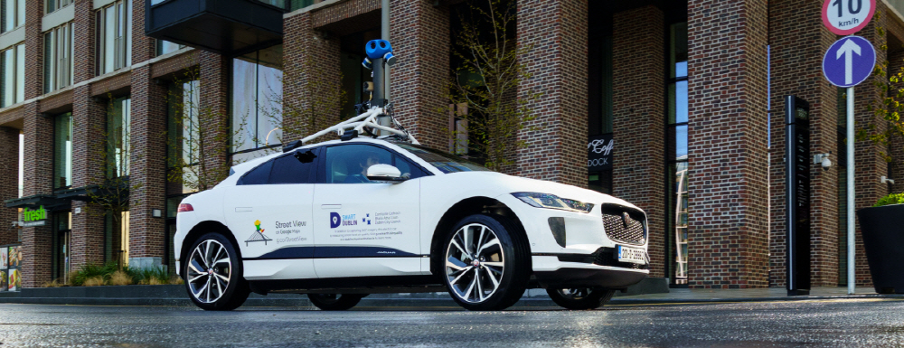
In downtown Dublin, Ireland, mapping begins with the Jaguar electric car, the I-Pace. By mounting a street view camera and air environment sensor on the roof of the vehicle, both map data and air pollution data can be measured simultaneously.
The atmospheric sensor, provided by Aclima, can measure nitrogen dioxide, carbon dioxide, and particulate PM2.5 in the atmosphere. The measurement data will be provided to Google Science Research Partners and will help map air pollution.
Google is also working with the Dublin City Council to implement the Air View Dublin project. Maps local atmospheric data based on Environmental Insights Explorer data. Accordingly, local governments can provide urban planning and pollution information.
The Jaguar iPace is already being adopted in Waymo autonomous vehicles. In the future, the adoption of electric vehicles is expected to increase not only in consumers but also in research. Related information can be found here.


Add comment